Travel notes, photos, videos, and comments from all over the world. I may earn income from purchases of advertised products or clicking links. Please follow via email. Thanks Geoff Sutton of Sutton Travels blog and YouTube
The Black Canyon of the Gunnison is so named because of the dark canyon walls.
I entered the south rim and hiked a number of off-road trails to various points overlooking the Gunnison River that winds a path far below the rim.
This park is new--established as a park in 1999.
Most of the rim trails are easy going.
The view named the painted wall because of the colors and figures changes color according to the sunlight. The photo below illustrates the immense height of this old wall compared to famous tall structures.
There's wildlife and a great variety of plants.
It's worth a visit if you are attempting to see America's National Parks as I am.
Rocky Mountain National Park (RMNP) is one of our favorite US parks. It was established 26 January 1915.
The scenery is magnificent--especially when getting off the road on various trails.
Off in the distance, you might see a moose like the one below. They can be seen in the lowlands.
Elk can be seen in various places. I saw this one by the roadside, parked and got back to photograph it whilst cars whizzed by.
And not to ignore deer though common in the US.
There are small mammals too like the yellow-bellied marmot. They are the size of a cat and known as a species of ground squirrels. They hibernate in winter.
Hiking above the tree line offers fantastic views and a chance to cool down in August. Here I am above 12,000 feet. It's one of the highest US parks with elevations up to 14, 259 feet at Long's Peak.
The Alpine tundra is vastly different from the mountain meadows. There is more than one tundra trails in the park.
When hiking the trails to mountain peaks, look among the rocks to find a Pika. They are herbivorous, about 7-inches long, and weigh about 7 ounces.
Of course, there's a diversity of flowers and plants as well.
Some small birds hidden in crannies.
And near the Western entrance, I saw these eagles.
Here's a few photos of the scenery at Rocky Mountain National Park.
Along Coyote Trail
Nymph Lake, Bear Lake Trail
A hike to Alberta Falls is worth the effort--see below.
You can still see some snow in August.
And here's the sign marking the Continental Divide-- the point where drainage runs off either to the Atlantic Ocean or the Pacific Ocean. You'll see it along Trail Ridge Road, which peaks at 12,183 feet.
And here's the park sign--what a great setting!
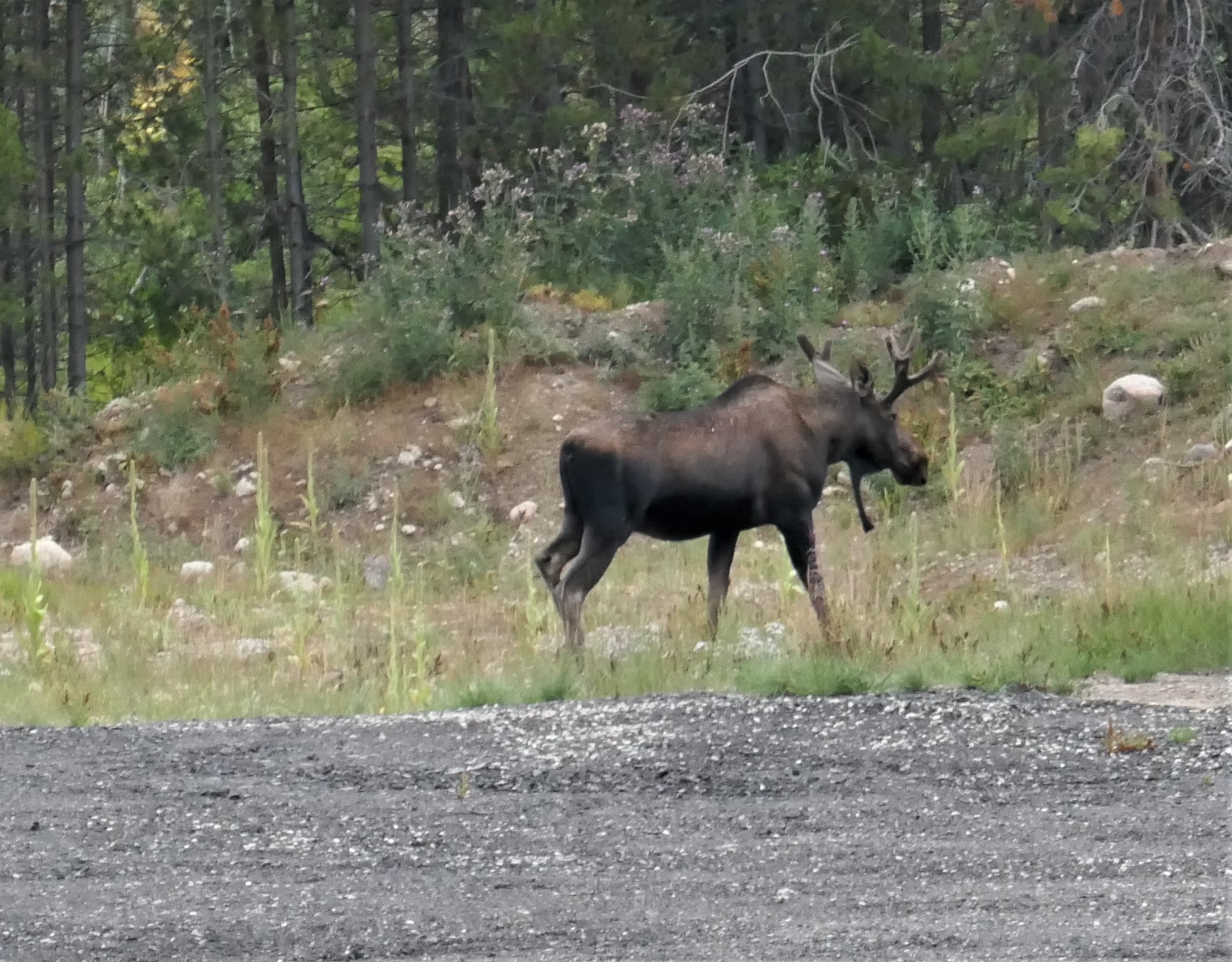
On leaving the park, I got this shot from my car -- a moose just outside the western entrance off route 34.
Some park notes
Native people were in this area for a long time. In recent history, Native tribes known as Ute, Arapaho, Cheyenne, Comanche and others were in the area that is now Rocky Mountain National Park. Read more about Native Americans in this area.